India opens its longest rail-cum-road bridge near China border

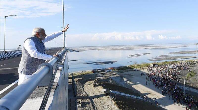
DHARAMSALA, Dec 26: India opened its longest rail-cum-road bridge over the Brahmaputra river at Bogibeel near Dibrugarh in Assam on Tuesday.
India’s Prime minister Narendra Modi inaugurated the 4.9km Bogibeel bridge over the Brahmaputra river yesterday by crossing it in an inaugural cavalcade.
“Bogibeel is not merely a bridge, but a lifeline for hundreds of thousands of people in the region. It has enhanced connectivity between Assam and other parts of the nation,” Daily Sabah quotes Modi as saying at a public rally at the site.
The Bogibeel Bridge will provide better connectivity to people in Assam and Arunachal Pradesh besides having strategic importance to India’s defence movement along its border with China in Arunachal Pradesh. It will also act as an alternative to the Kolia Bhomora Setu, Tezpur in providing connectivity to nearly five million people residing in Upper Assam and Arunachal Pradesh.
The bridge has been designed to bear the weight of India’s heaviest 60-tonne battle tanks and so that fighter jets can land on it, noted a report on Aljazerra.
The train will run five days a week. The 4.9-km bridge will cut down the train-travel time between Tinsukia in Assam to Naharlagun town of Arunachal Pradesh by more than 10 hours.
As it is located in an area of intense rainfall, construction has been significantly slow as it has to be carried on only during a period of four dry months between November and March. It took 16 years and $800m for India to construct Asia’s 2nd longest rail-cum-road bridge and its first bridge with fully wielded steel-concrete support beams that can withstand earthquakes of magnitudes up to 7 Richter Scale and it that has a serviceable period of around 120 years.
The McMahon Line demarcation is the current effective boundary between China and India after the Chinese occupation of Tibet. It is a demarcation line drawn on the map referred to in the Shimla Accord, a treaty signed between Britain and Tibet in 1914.
China calls the Shimla Accord a treaty that was never validated and has laid claim to around 90,000 square kilometres of Arunachal Pradesh as its own territory, which India resolutely rejects.