Chinese Geologists’ Study Contradicts Beijing’s Safety Assurances on Yarlung Tsangpo Mega Dam in Occupied Tibet
By Tenzin Chokyi
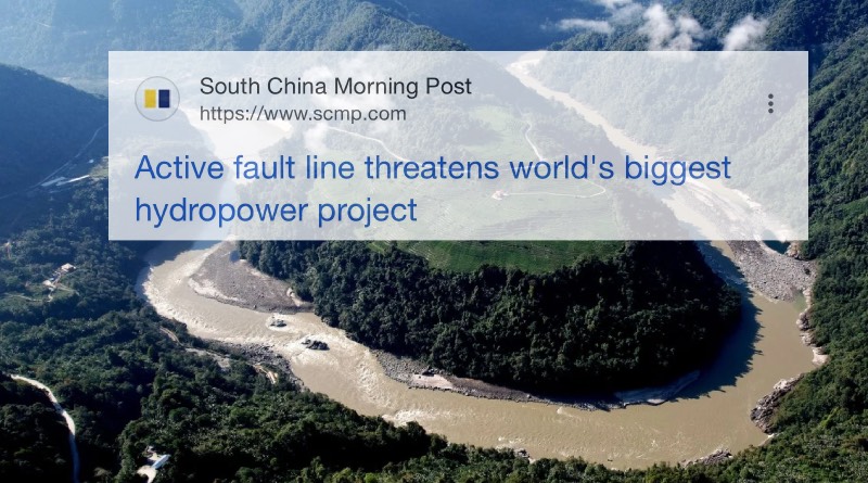
DHARAMSALA, 14 July: A study by Chinese geologists has raised fresh questions over the safety of China’s massive hydropower project on the Yarlung Tsangpo in occupied Tibet, identifying an active fault beneath the construction site despite Beijing’s repeated assurances that the project meets the highest safety standards and would reduce disaster risks.
The findings, published last month in the Chinese-language journal Sedimentary Geology and Tethyan Geology under the supervision of the state-owned China Geological Survey, identified the newly named Paizhen Fault beneath the project area in south-eastern Tibet and warned that it remains geologically active. The study came to light after the South China Morning Post reported on it on 9 July.
According to the researchers, the fault has remained active since the Pleistocene epoch, with continued movement fracturing the Earth’s crust and surrounding rock formations. They warned that the weakened geology could threaten the long-term stability of dams, reservoirs, roads, bridges and tunnels associated with the hydropower project.
The researchers also said the Paizhen area, where construction is underway, lies within the reservoir zone of the downstream Yarlung Tsangpo hydropower station and in one of the most seismically active sections of the Himalayan belt. They cited the magnitude-6.9 Mainling earthquake in 2017 as evidence that the region remains tectonically active and cautioned that future earthquakes could trigger landslides, slope failures and damage to infrastructure. To reduce those risks, they recommended reinforcing unstable slopes and constructing retaining structures around the project.
The study further warned that the area’s loose geological structure and weakened bedrock significantly increase the risk of reservoir slope failures caused by prolonged water saturation, underground fault movement and earthquakes, posing potential threats to the project’s long-term safety.
The findings contrast with Beijing’s longstanding position that the hydropower project has been designed to the highest industry standards. In December 2024, Chinese authorities said extensive geological surveys and technological advances had laid the foundation for the project’s “science-based, secure, and high-quality development.” A Chinese Foreign Ministry spokesperson also said last year that the project would help prevent disasters along the river while protecting the ecological environment and would not adversely affect downstream regions.
China officially launched construction of the multi-billion-dollar hydropower project in Metok Dzong (Chinese: Medog County) in July 2025. Planned for the lower reaches of the Yarlung Tsangpo, known downstream as the Brahmaputra, the project is expected to generate more than 60 gigawatts of electricity, roughly three times the installed capacity of the Three Gorges Dam, making it the world’s largest hydropower project.
The project has drawn criticism from Tibetan environmental advocates as well as concerns from India and Bangladesh over its environmental impact, seismic risks and potential implications for downstream water security. Critics argue that constructing such a massive dam in one of the world’s most earthquake-prone regions could endanger millions of people living downstream if a major geological disaster were to occur.
The study was conducted by researchers from Chengdu University of Technology, the Civil-Military Integration Centre of the China Geological Survey and the Middle Yarlung Zangbo River Natural Resources Observation and Research Station.