Focus less on defining what Tibet is based on political boundary: Tsering Wangyal Shawa

DHARAMSALA, 7 Aug: Tsering Wangyal Shawa, the special guest at the inauguration of the Tibet Museum’s temporary exhibition titled “Mapping Tibet” said that we should concentrate less on defining what Tibet is based on the political boundary and focus more on collecting, creating, standardising, and understanding cultural and geographical feature names in the Tibetan language so that we can own our place.
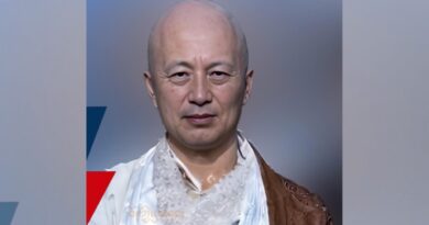
Tsering Wangyal Shawa, the Geographic Information Systems (GIS) and Map Librarian from Princeton University Library made the remarks as he maintained that “A boundary drawn on the map is not permanent, many country’s boundaries have changed over time. In fact, sharp boundaries were drawn by the nation-states to control, classify, collect taxes, and restrict people’s movement because the government distrust the people who move freely from place to place.”
“Boundaries divide people and invoke nationalism by classifying people who live inside and outside. Boundaries also sharpen the identity of the ethnic group into a more rigid group.”
The recipient of the 2020 MAGIRT Honors Award added that “In my opinion, as a Tibetan, living in exile, at this stage of our freedom struggle, we should concentrate less on defining what Tibet is based on the political boundary because there are different ways to define Tibet. Instead, we should focus more on collecting, creating, standardising and understanding cultural and geographical features names in the Tibetan language so that we can own our place.”
Declaring place and geographical feature names as an important part of Tibet’s cultural environment, he added “If you look at our map these days, it is difficult to recognise many places located in Tibet because they have a Chinese-sounding name. I see a danger of losing the original Tibetan place name over time.”
He added that the changing generation of Tibetans born in exile’s less physical connection to Tibet and the restriction on Tibetans living in Tibet to link Tibetan place names to the actual location at the national level aggravates the matter.
“With the Chinese government writing the place name in Chinese and changing them altogether, I think, collecting and preserving a place and geographical feature names in the Tibetan language will not only help us understand and connect the place to our cultural roots but also if you manage to collect and develop a proper place name database, we could share the database with large commercial or crowdsource mapping companies, research institutions and governments in the world so that in future, the Tibetan place names are shown properly on most mapping applications in the world,” he concluded.
Tenzin Topdhen, the Director of the Tibet Museum of the Department of Information and International Relations (DIIR) Central Tibetan Administration described the temporary exhibition as a handwork of a team of 8 staff from the Museum.
The temporary exhibition showcasing 42 maps of Tibet since the early 17th century was inaugurated by the DIIR Minister Norzin Dolma. The exhibition will run till October 5 and after that, it will become part of the museum’s traveling exhibition projects.